The early Mormon settlement of Utah, as was most of the West, centered around sources of water and irrigable lands. The many rivers and streams flowing from the canyons along the western slope of the Wasatch Mountains provided the largest and most productive agricultural areas for the early settlers. Moving south from the Wasatch, dividing the dry sage brush desert to the west from the red rock canyon country to the east, a series of valleys bordered by mountain ranges oriented in a general north and south direction provided addition locations for settlement. Parley P. Pratt, LDS Apostle, led an exploratory expedition south in the late fall and winter of 1849-50 traveling about 800 miles down and back what is roughly the rout of current Interstate Highway 15. Soon settlements were started in the areas the expedition identified as favorable. In 1851 the communities of Nephi, Fillmore, Parowan and Cedar City were all established. Before the end of the decade, the towns of Beaver, Washington, Scipio and Gunnison had been settled; and by the end of the 1860’s communities up and down the Sevier River were growing and thriving. (1) However, to the east of the Sevier River the land remained very much a mystery.
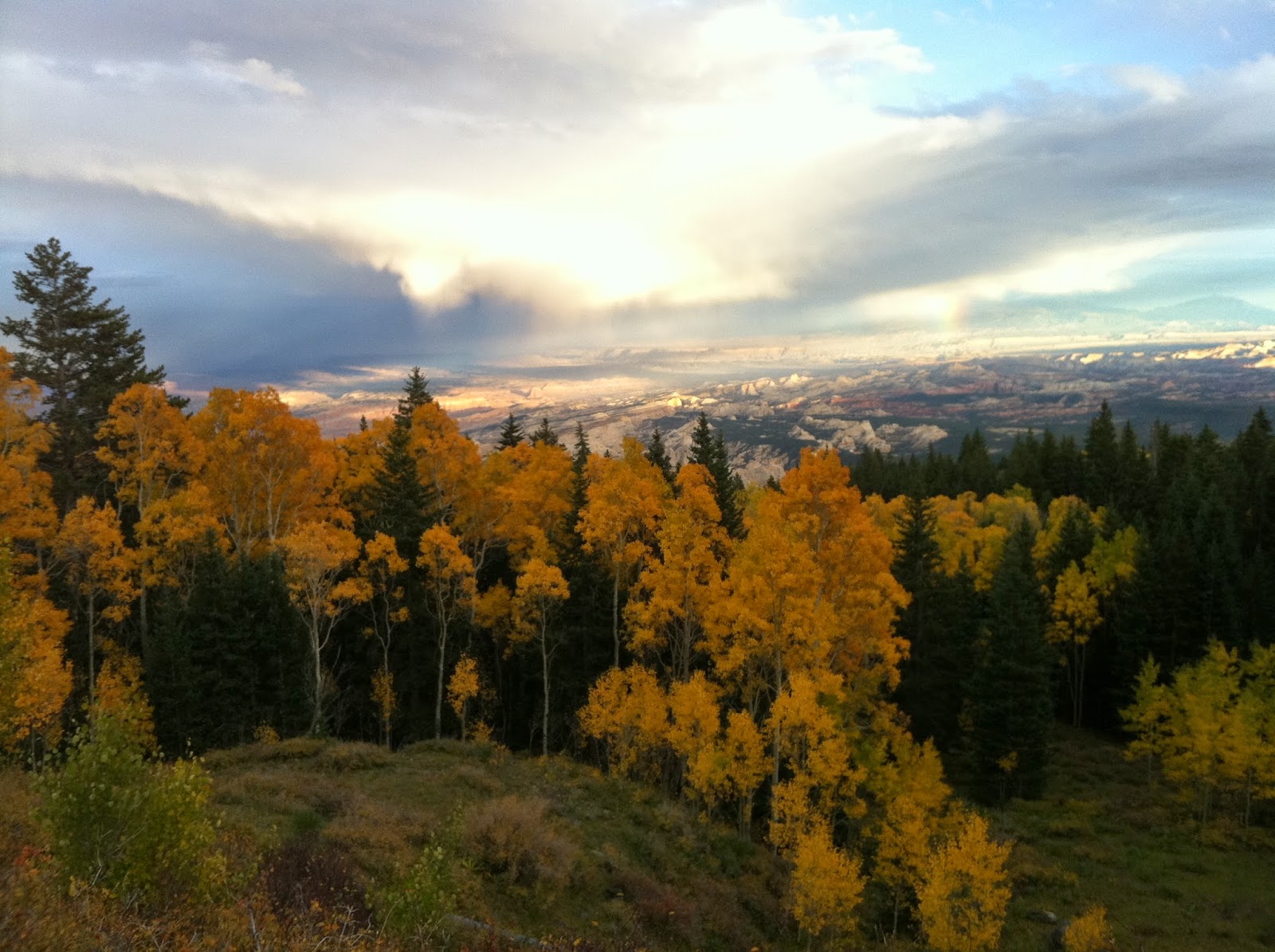
| Rough terrain along the lower Fremont |
 |
| The Grand Gallery, Canyonlands National Park, eastern Wayne County |
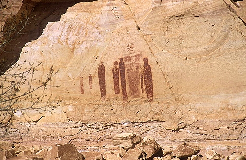
| Petroglyphs along the Fremont River, Capital Reef NP |
Coinciding with the decline of the Fremont culture, was the arrival of the Numic-speaking people – ancestors of the Paiute, Shoshone and Ute tribes. Some believe the Numa evolved from the Anasazi and Fremont, while other believe they immigrated from the western or northern Great Basin. (5) Oral traditions among the Paiute and Ute would suggest their ancestors were living in these regions even before the immigration of the Ancestral Pueblo or Fremont. (6) Regardless of their origins, when the first white men arrived in the region in the mid 1800’s, the Numa-speaking tribes had lived there continuously for almost 1000 years. (7) Prominent among the Numa-speaking people were the Utes.
| Paiute Indians |
Rabbit Valley and the Fremont River was just a small part of the vast area the Utes called home that extended from Central Utah to the eastern slope of the Rockies, north into Wyoming and south to New Mexico. (8) Largely a hunter/gatherer culture, they moved according to food sources and weather. They hunted the abundant deer, elk, antelope, bear, mountain sheep and small game found throughout their lands. Buffalo and buffalo hides were also a major source of food, shelter and clothing. Tribal oral traditions have buffalo residing in Rabbit Valley as late as 1840 (9). They fished the streams and frequented Fishlake. They gathered fruit, nuts, seeds, berries and roots. (10)
 |
| Ute Indian Families |
The Utes “were scattered out over the land in family groups or bands,” Coneth wrote. The extended family was “the center of Ute life,” and there was no “chief” over all of the Utes. Those with special knowledge, skills, or wisdom on respect, and often served in leadership positions during times of need. “In their search for food and shelter, each band traveled over a wide area, usually in route from the desert or plains lowland in winter, to the mountains and plateaus in summer”. These scattered groups came together at various times for meetings, dances, and other amusement, and marriages. The Ute groups in the Fish Lake area became closely associated with the Southern Piute groups that also utilized the lake and its surrounding forests and streams. (11) (See appendix A at end of chapter)
 |
| Ute Indians |
The first contact these native peoples had with those of European descent would have been in the late 1500’s or early 1600’s as the Spanish led expeditions into their territory. With this contact came the introduction of the horse which were thought to have reached the Utes north of the Colorado River by the mid 1600’s. (12) Father Escalante passed through much of the Ute territory during his 1776 expedition, however, he never passed within a 100 miles of the rugged valleys of the Fremont. (13) Later the Spanish Trail – a highway of commerce between the pueblos of New Mexico with the haciendas of Southern California used from the early 1800’s through about 1846 – brought large pack trains of mules from Santa Fe loaded with woolen blankets and other products headed west to Los Angeles to be exchanged for horses and mules. Later in the fall, large herds of animals procured in California would pass back over the trail headed east. While the trail did not enter the valleys along the Fremont River, a route usually used only in late summer did pass by Fishlake. The returning traders would have come up Grass Valley along Otter Creek before climbing up onto the plateau country overlooking Rabbit Valley about 15 miles to the southeast. From there they passed by Fishlake, through Seven Mile then joined the main route in Salina Canyon. (14) While we have no written record of white men entering Rabbit Valley from the Spanish Trail, we can assume at least a few curious travelers would have ventured therein.
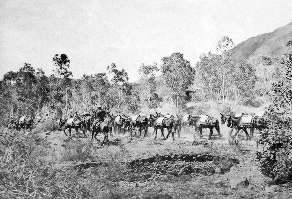 |
| Mule trains on the Old Spanish Trail |
While we have no written records of Euroamericans visiting Rabbit Valley from the Spanish Trail, John C. Fremont, prominent western explorer, did pass through during the winter of 1853-54 in his search for a possible route for the transcontinental railway. (15) The first Mormon explorations into the area were during the Blackhawk war of the 1860’s as Mormon militia from the established communities to the west, pursued marauding bands toward their safe havens in the east. In September of 1865, General Warren S. Snow, along with 103 militia were involved in a battle near present day Bicknell Bottoms in what has been referred to as the “Battle of Red Lake”. (See Appendix B at the end of this chapter). The following June or July, General William B. Pace led another group of men through Rabbit Valley and on to the rugged Capital Reef National Park area in pursuit of Indians who had stolen cattle along the Sevier (16). Later that same summer, a company of men under the command of Captain James Andrus came up from the south and passed along the northern slope of the Boulder Mountain before passing over Parker Mountain and on to Grass Valley. (17)
 |
| Cathedral Valley east of Thousand Lake Mountain. It is thought John C. Fremont passed through here on his way to Rabbit Valley on the west side of Thousand Lake Mountain. |
| Bicknell Bottoms along the upper Fremont River. Location of the Battle of Red Lake. |
The major hostilities of the Black Hawk war having ended, in the early summer of 1873 Brigham Young sent a group of 19 men explore the land southeast of the Sevier Valley, meet with the local Indians and gain permission to establish communities. After meeting with the local Indians at Fishlake and Grass Valley, the company traveled over the mountain and down into Rabbit Valley. The little valley with not one, but two streams meandering through grassy meadows made an impression on the travelers. The abundant water, plentiful game, and friendly Indians were happy findings. One of the men, A.K. Thurber liked the area around present day Bicknell so much, he named it after himself. On the return trip, at Cedar Grove, just south of present day Burrville, a peace treaty was negotiated. Soon after, President Young called for settlements to be established. Thus opened up a new, all be it remote, location for those looking for a new start, or to establish a place of their own. (18)
1. http://www.uen.org/utah_history_encyclopedia/
2. Miriam B. Murphy, A History of Wayne Conty, p. 53, 1999, Utah State Historical Society
3. Rosemary Sucec, Fulfilling Destinies, Sustaining Lives: The Landscape of the Waterpocket Fold. An Ethnographic Overview and Assessment of the American Indian Histories and Resource Uses within Capital Reef National Park, Utah, and on Lands Surrounding It. 2006, p. 40. National Park Service, U.S. Department of Interior.
4. Murphy p. 41
5. Sucec, p. 97
6. Sucec p. 100
7. Sucec p. 97
8. Murphy p. 45 : “The area the Utes called home was a vast 225,000-square mile domain extending from the area of the present towns of Fillmore, Utah to Colorado Springs, CO, and from Baggs, Wyoming, to Abiquiu , New Mexico. Some hunters even ranged beyond these limits, according to tribal historian, Fred A Conetah. This land, with its many different environments, provided the Utes with “sources of food, clothing, and weapons, places of refuge from raiding neighbors…sanctuary from summer heat and …shelter from winter cold, meeting grounds for councils and ceremonies, and sacred spots for healing the sick.” The Utes hunted the abundant wild game of the area: deer, antelope, buffalo, elk, bear, mountain sheep and smaller animals. They fished in the streams throughout the territory, and the resources of Fish Lake were well known to them. They gathered fruit, nuts, seeds, and berries and edible roots and learned the healing properties of other plants. Some Utes farmed, but more often they obtained corn, beans, and squash by trading with Pueblo peoples in the Southwest
9. Sucec p. 110
10. Murphy p.45
11. Murphy p.45
12. Sucec p. 113
13. Sucec p.117
14. Sucec p. 119
15. Susec p. 131
16. Susec p. 159
17. Murphy p. 61
18. Murphy p. 62
Appendix A:
Miriam B. Murphy, A History of Wayne Conty, p. 53, 1999, Utah State Historical Society
Pg 46: “Southern Paiutes and Utes living here before eh arrival of the Euro-Americans adapted to the semi-arid environment…through a settlement pattern called “transhumance’. To best utilize the wide range of plant and animal resources available seasonally at different elevations, these people moved camp regularly. Seeds were gathered from grasses…and animals such as antelope, mountain sheep, and rabbit were hunted.” “For shelter the Paiutes traditionally utilized windbreaks, brush shelters, and more substantial winter dwellings made of juniper or aspen posts with wild ryegrass as filler, held in place by bark and /or willow boughs. Some winter houses were slightly excavated pit houses’. Whether temporary or semi-permanent, these dwellings were located near a water source. The Southern Paiutes used a ‘highly developed’ variety of basketry, ‘which served their needs in transporting both wild and cultivated plant foods’. Many family groups made Fish Lake a regular stop on their foraging excursions, especially during the spring when the fish were spawning. In their winter camps they passed on their rich oral tradition, including myths, tales, a very large repertoire of songs for many occasions, and proverbs. Their traditional dance was the circle or round dance. From the Utes they borrowed the bear and turkey dances.”
Appendix B:
History of Indian Depredations in Utah, 1919, Peter Gottfredson. Pg 167 Battle at Red Lake, Snow, Taylor and Frandsen Wounded.
“Nearly two months had passed since there had been any serious outbreak. But Indians wre prowling round Circleville, and it was reported that they had a rendezvous somewhere near Fish Lake, east of Sevier Valley. General Warren S. Snow with 103 men went up the River as far as Circleville; he had with him colonel John Ivie’s company of cavalry from Mount Pleasant, and Captain N.S. Beache’s company from Manti, with some recruits from other companies; they went to investigate the condition of affairs and arrived in Circleville September 18, 1865. On the 19 they marched up the east fork of the Sevier to Clover Flat, where they encamped for the night. There they got onto the Indian’s trail, which they followed over the plateau between Grass and Rabbit Valleys. Night overtook them before reaching the latter valley; it was raining and very dark; they made camp in the head of a very rough canyon. Early next morning (September 21st) Ezra Shoemaker and another man went out to reconnoiter; they found the track of a pony which had come within half a mile of camp and turned back; they reported what the had seen. The company then worked their way down the canyon. When they reached the flat country, at a small lake or pond called Red Lake, near Thousand Lake Mountain, they made a halt. General Snow and Col. Ivie went up a black, rock ridge to get a view of the country and its surroundings. When near the top, Col Ivie saw a ramrod wiggling behind a brush only a few paces away, and exclaimed “There they are,” when a volley was fired from ambush, one bullet hitting and seriously wounding General Snow in the shoulder. The men retreated to the company, when a general battle ensued; the Indians firing from ambush on top of the hill. The Indians over-shot - the bullets singing over the heads of the soldiers, striking in the water, fairly making it boil. Orson Taylor of Richfield received a serious gun-shot wound in the side. George Frandsen of Mount Pleasant, while concealed in a gully, trying to get a shot at an Indian he had seen, received a bullet high I the forehead, the missile plowing through his hair and filling his eyes and face with blood, but it caused no further injury. A short retreat was ordered for the purpose of getting flanking movements on the savages, when it was noticed that one of the pack animals had been left behind. Ezra Shoemaker of Manti and another man went back, and in the midst of a shower of bullets from the enemy recovered the animal with the pack. The fighting continued till night and several Indians were killed. The militia crossed back over the mountain in the night to Grass Valley and made camp. Next day they marched down King’s Meadow Canyon to Glennwood, where they separated and returned to their respective homes.”
No comments:
Post a Comment